
Mohapatra said there is a 40 per cent chance of a normal rainfall, 22 per cent above normal, 12 per cent excess and 18 per cent below normal.


The last time the southwest monsoon arrived earlier than in 2025 -- that is, back in 2009 -- the rains lost steam after the early onset and ended the season with almost 23 per cent deficient rainfall, which was the lowest recorded average rainfall in several decades over India.

Installed at a cost of Rs 450 crore in Pune and Noida, the two supercomputers are set to fundamentally alter the weather forecasting scenario in India by enabling the IMD to forecast severe weather conditions up to the sub-district or block level.
There are no plans of creating artificial rain.
Caught in a vicious grip of inflation, the government on Wednesday announced that the south-west monsoon, crucial for the nation's agricultural well being, would be near normal this season. "India Meteorological Department's long range-forecast for the 2008 south-west monsoon season is that the rainfall for the country as a whole is likely to be near normal," Earth Sciences Minister Kapil Sibal told reporters in New Delhi.

With rainfall and monsoons becoming highly unpredictable partly due to climate change and partly due to usual changes in weather patterns, it is such innovations by IMD which will help in planning better, reports Sanjeeb Mukherjee.

From a few rain gauges in 1875 to rivalling the world's best weather agencies, the India Meteorological Department (IMD) has weathered its way to becoming a global leader in forecasting.

The exercise, Agriculture Minister Radha Mohan Singh said, will help ease any possible impact of sub-par rainfall on farmers.
Market for localised weather forecasting in India offers immense scope; credibility of data a concern.

Data since 2005 show that the five years with the highest rainfall saw average market returns of 8.98 per cent, while the five driest years returned 25.7 per cent on average.

The southwest monsoon is likely to arrive over Kerala on May 31, a day earlier than its normal onset date, the India Meteorological Department (IMD) said.

The India Meteorological Department introduced the present LRF models during 2007 following review of the old forecasting system.

'All El Ninos are not associated with the deficient monsoon.'

July and August are expected to receive 107 per cent and 104 per cent of rainfall

The official India Meteorological Department (IMD) and the private Skymet Weather Services have made widely divergent monsoon forecasts.
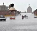
The IMD chief also allayed fears of occurrence of an El-Nino.

IMD has decided to increasingly use cutting-edge technology such as artificial intelligence (AI) and machine learning (ML) in forecasting, both to avoid such glitches and to counter the disruption of normal seasonal patterns as a result of climate change. It has formed various internal sub-groups of senior officials and meteorologists to decide on how best to use AI and ML in predicting cyclone intensity, and in making short-range weather forecasts (those valid for up to three hours) as well as long-range forecasts.

The rains have so far been four per cent below normal.
Contrary to some predictions, rainfall is adequate so far.
With El Nino emerging, forecasts rainfall at 95% of long-period average.

The met department said that rainfall in August is projected to be within the normal range at 97% of LPA. In August and September, India receives around 43 mm of rainfall.
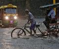
Steady progress in June; north and central regions to get good pre-showers

'Nobody asked us to work on this. It was on our own that we decided to embark on this journey.'

The IMD on its part is sticking to its forecast of July rainfall.

Sowing had started on a sluggish note in several parts of the country because of delay in the onset of the monsoon but has picked up pace subsequently as the rains progressed and performed appreciably well in August.

IMD will present its month-wise and region-wise forecast in June.

Kerala has been receiving rainfall since Saturday and 10 out of the 14 weather monitoring stations in the state have received more than 2.5 mm rains.

Till Thursday, the country had received 41 per cent less June rainfall than normal - the scantiest in a decade and one of the rarest occasions when the shortfall in the month was more than 30 per cent - private weather forecaster Skymet said in its daily weather forecast on Friday.

The Met office had said Monday that significantly higher-than-normal temperatures may have an adverse impact on wheat and other crops.
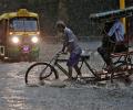
Monsoon is likely to be 96 per cent of the long period average

The India Meteorological Department's first monsoon forecast for this year would have gladdened many a heart with the hope of plentiful rain, after two drought years.

India now faced a higher likelihood of a drought in some parts, as monsoon rain would be less than predicted in April, private weather forecaster Skymet said on Friday.
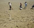
Rain deficiency in eastern and western Uttar Pradesh, Bihar, Jharkhand, Gangetic West Bengal, Assam and Meghalaya is 20-46 per cent less than normal as of June 17.

Data spanning the years 1951 to 2014 show that temperature and pressure conditions at specific locations in the Arctic region during the pre-monsoon period correlate with the Indian summer monsoon rainfall, points out Charu Bahri.

The city's 24-hour Air Quality Index, recorded at 4 pm every day, stood at 418, up from 334 the previous day, and it may trigger stringent restrictions under the third stage of the graded response action plan to mitigate hazardous conditions.

The southwest monsoon might finally start withdrawing from parts of North-West India over the next three days, signaling the end of its four-month journey over the country that started in June, the India Meteorological Department (IMD) said. However, though the retreat might begin from next week, the rains might not descend quickly, as the met department predicted fresh spells of rains in Vidarbha, Chhattisgarh and east MP on September 21-22 and over Odisha, Coastal areas north Andhra Pradesh and Gangetic West Bengal on September 19-21. "Due to anti-cyclonic flows over northwest India at lower tropospheric levels, dry weather is very likely over west Rajasthan, Punjab, Haryana, Chandigarh and Delhi during the next five days. "Hence conditions are becoming favourable for the withdrawal of Southwest Monsoon from parts of northwest India during next three days," the IMD said.

G P Sharma, President (Meteorology) of the Skymet Weather said the Long Period Average of the rainfall during June to September will be 103 per cent with an error margin of plus or minus 5 per cent.

Rains have been 5% below normal so far, but Met department sticks to its forecast
 © 2026 Rediff.com - Advertise with us - Disclaimer - Privacy Policy - Sitemap - Feedback - About us - Terms of use - Grievances